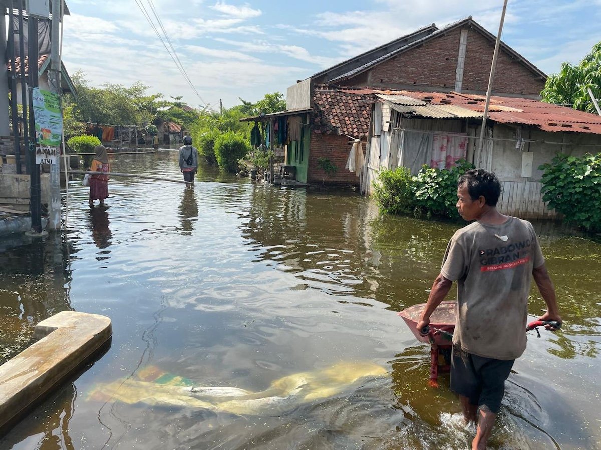
Indonesia has unveiled an ambitious plan to construct a giant sea wall stretching more than 500 kilometers along Java's north coast, aiming to protect the world's most populous island from rising sea levels and frequent flooding. The project, framed as a flagship economic initiative, carries a price tag of at least US$80 billion and is slated to begin construction in September 2026. It will be overseen by multiple government agencies and subject to scrutiny from Indonesia's Corruption Commission (KPK), though observers question whether such oversight will prove effective.
The proposal includes a large lagoon behind the concrete barrier, but civil society groups have raised alarms about potential environmental and social costs. They warn the wall could accelerate sand mining, degrade mangrove ecosystems, and disrupt the livelihoods of fishing communities. These groups fear the project will exacerbate existing ecological damage from industrialization along Java's coast, and argue that a wall alone is not the answer to the region's flood risks.
Flooding and Subsidence: A Complex Crisis
Java's north coast faces a dual threat: land subsidence driven by excessive groundwater extraction, building loads, and mangrove deforestation, combined with rising sea levels linked to climate change. Indonesia has a long history of managing floods through canals, dykes, land reclamation, and river straightening, but such measures often prove temporary or worsen the problem. Our recent research highlights how inconsistent communication from different levels of government can undermine public understanding of the need to reduce groundwater pumping.
In three villages in Kendal, central Java, we observed that flood defenses like seawalls, raised roads, and home grants of around A$2,000 partially addressed risks but rarely covered full costs. Poorer families sometimes declined assistance once they understood the co-financing burden. Meanwhile, raised roads and flood walls channeled water into nearby low-lying homes, reshaping livelihoods and community dynamics. Saltwater intrusion also crept onto productive land that had previously avoided regular tides, threatening food security—one of the stated goals of the giant wall.
Recent modeling suggests offshore structures can reduce storm surge heights in some locations, but outcomes vary by local underwater conditions. Historically, such coastal adaptation projects have been sites of political argument and corruption. The massive cost of the giant sea wall will be drawn from provincial and national budgets, as well as public-private partnerships with countries like the United Arab Emirates. Questions remain about who will fund long-term maintenance.
Strategic Implications for Australia and the Region
For Australia, Indonesia's closest neighbor and a key strategic partner, how Jakarta manages this project will shape regional security. The Department of Foreign Affairs (DFAT) has historically collaborated with Indonesia's planning agency BAPPENAS on water infrastructure. Failing to consult properly with Indonesian stakeholders could lead to political fallout, while inaction might cause food insecurity as rice fields become saline. Both scenarios risk creating a less stable Indonesia, something Canberra wants to avoid.
The project also intersects with broader economic pressures. Indonesia's debt wall tests an economy running on borrowed time, and the rupiah's recent volatility has revived memories of the 1997 crisis. Meanwhile, Japan's ammonia co-firing plan risks prolonging Indonesia's coal dependence, complicating efforts to address climate-driven flooding.
The best question is not whether to build a wall, but whether it can work as intended. If Indonesia can regulate and enforce groundwater extraction, clean rivers, and design coastal works with local communities, the giant sea wall could become a useful part of a broader adaptation strategy. Without those reforms, it risks becoming an expensive folly that redistributes harm and entrenches inequity.